Drone Photography in India: Rules and Permissions You Need to Know
 Feb, 1 2025
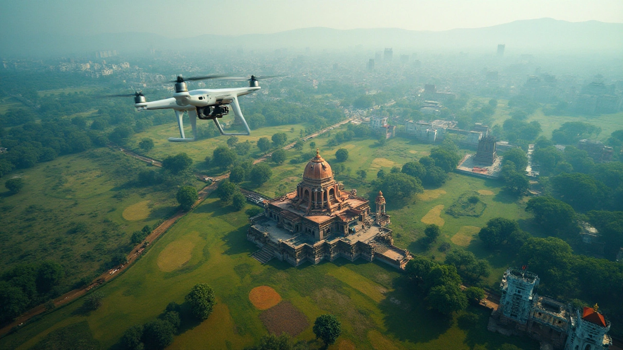
Flying drones across India's diverse landscapes offers an exciting perspective on photography, capturing everything from bustling city streets to serene rural fields. However, the skies are not entirely open for all, and understanding the rules that govern drone usage in India is critical. Without the right permissions, what starts as a creative endeavor can quickly turn into a legal hassle.
India has developed a comprehensive set of regulations concerning drone usage, categorizing drones based on their weight and purpose. Knowing these categories and the legal requirements associated with them is the first step towards a successful drone flying experience in India. Whether you're a hobbyist looking to explore new angles or a professional aiming to capture a breathtaking shot, being informed about the permissions and zones can make all the difference.
As you prepare to take off, let's delve into what you need to know about flying drones in India without running afoul of the law. From understanding the types of drones to practical tips for a safe flight, navigating the regulatory environment becomes a fascinating part of your drone photography adventure.
- Understanding Drone Categories
- Legal Permissions for Drone Flight
- Restricted and Allowed Zones
- Tips for Safe and Creative Drone Photography
Understanding Drone Categories
Flying a drone in India involves a wonderful blend of technology and creativity, yet it comes with a legal framework that dictates how various types of drones can operate. The Directorate General of Civil Aviation (DGCA) has clearly outlined classifications based on drone weight, each with its unique set of rules. As a drone enthusiast or a professional seeking to dive into drone photography India, understanding these categories is vital.
The primary classification system divides drones into five categories: Nano, Micro, Small, Medium, and Large. A nano drone weighs less than 250 grams and is often seen as a mere toy by many. Surprisingly, such tiniest flyers are the most freely operated drones, requiring no permission for flights below 50 feet. Nano drones, however, are not allowed for commercial use like drone photography India involving real estate or events.
In stark contrast, a Micro drone weighs between 250 grams to 2 kilograms. These require a unique identification number and operator’s permit for all commercial activities. If your drone photography project includes small drones (2-25 kg), be prepared to go through additional layers of approval, such as remote pilot licenses and operator permits.
The Economic Times reports: "As drones become more popular, commercial uses are expected to grow, which is why India’s DGCA has focused on strengthening the categorization system."
Some enthusiasts might even explore larger and more technical options. Medium and large categories cover drones from 25 kg up to over 150 kg. These beasts of the sky require even more stringent regulatory oversight, often demanding detailed flight plans and specialized training. Large drones can shape industries like logistics and heavy-equipment photography but are generally not for the average hobbyist or for casual drone photography India.
Being aware of the exact category your drone falls into isn't just about compliance; it’s about fitting the right drone into your creative vision. Identification numbers, permits, and training all play into making this experience a safe and enriching one. By aligning with the regulations, you also boost the opportunity to fully explore the breadth of opportunities offered by drone technology, allowing your creative ideas to soar high above the Indian landscapes.
| Category | Drone Weight | Permission Requirement |
|---|---|---|
| Nano | < 250g | No permission below 50ft |
| Micro | 250g - 2kg | UID + Permit for commercial use |
| Small | 2kg - 25kg | License + Permit |
| Medium | 25kg - 150kg | Requires detailed flight plans |
| Large | > 150kg | Specialized training |
Legal Permissions for Drone Flight
In India, the dream of sending a drone soaring into the sky comes with the responsibility of adhering to certain legal requirements. Navigating these regulations can be daunting, but understanding the key aspects is essential for a smooth flight experience. The government of India classifies drones into five categories: Nano, Micro, Small, Medium, and Large. This classification is primarily based on weight, affecting what permissions are necessary for flight. The smallest category, Nano drones, are those weighing up to 250 grams, while Large drones weigh more than 150 kilograms. Different rules apply to each, and you must be aware of which category your drone falls into before operating it.
The cornerstone of Indian drone regulation is the Digital Sky Platform, an online portal where drone operators must register their devices. This platform was established to streamline the process and ensure that all drones in the air are properly accounted for. To fly any drone, except for those in the Nano category, operators must obtain a permit known as an Unmanned Aircraft Operator Permit (UAOP). This permit involves submitting detailed documentation that outlines the purpose of your drone photography activities, the specifications of the drone, and personal identification information. The process can be intricate, but it is a necessary step to ensure safety and security in the skies.
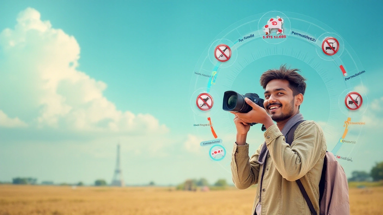
The Indian Directorate General of Civil Aviation (DGCA) oversees these regulations and issues the necessary permissions. From commercial use to recreational drone photography, the core of compliance lies in recognizing that each flight needs clear authorization. While Nano drones for personal use might not require a UAOP, it is still mandated that flights remain below a maximum altitude of 50 feet. All other categories require further permissions, including permission from the local police and a flight plan submitted to the DGCA. An added layer of security is the No Permission No Takeoff (NPNT) mandate, which ensures a drone cannot take off without approval via the Digital Sky Platform.
As part of a comprehensive approach to drone regulation, India also has specific zonal regulations. Red zones are strictly no-fly areas, often encompassing government buildings and military installations. Yellow zones require special permissions, and green zones allow freer flight, so long as standard protocols are followed. Notably, even within green zones, flights near airports require additional clearance.
The DGCA states, "Operating a drone without the necessary permissions can attract significant penalties, including fines and the confiscation of the drone." Understanding these zones is crucial for planning your drone routes and determining which areas require additional permissions.
The growing interest in drone photography India is met with enthusiasm and caution. The DGCA periodically updates its policies to stay in line with technological advancements and address privacy and safety concerns. As drone technology evolves, staying informed about the latest guidelines ensures you can enjoy breathtaking aerial shots while respecting the legal framework. Keeping track of updates from the DGCA and the Digital Sky Platform is akin to having a checklist of your photography gear – both are essential for a successful flight.
Restricted and Allowed Zones
Navigating the skies with your drone in India isn't just about mastering the controls—it's about understanding the landscape from a regulation perspective. Flying a drone, especially if you're involved in drone photography in India, requires keen awareness of restricted and allowed zones. The Directorate General of Civil Aviation (DGCA) has established clear guidelines, marking the skies into zones akin to traffic signals: Red, Yellow, and Green.
Let's start with the Red Zones. These areas are no-go zones for drones under any circumstance. Red Zones include airports and their surrounding areas, vital military installations, national parks, and sensitive spaces like the India Gate in Delhi. Intruding upon these zones can lead to severe penalties, including fines and possible imprisonment. Cameras aren’t the only ones monitoring here; legal eyes are ever-watchful too. "Understanding and respecting no-fly zones is just as critical as knowing your frame rates," as one renowned Indian drone photographer once noted.
Transitioning to the Yellow Zones, here lies the potential for obtaining conditional permissions. These areas, categorized as controlled airspaces, require explicit approval from local authorities or the airports themselves. The heart of many urban areas falls into this category. For instance, if you're aiming to capture the skyline of Mumbai, conducting a proper assessment of where you stand and what permissions are required is essential. Working with the local police and other regulatory bodies ahead of time ensures that your equipment remains in your hands and not confiscated as evidence.
Finally, the Green Zones are where drone photographers can breathe a sigh of relief. These are primarily open countryside and rural areas far from controlled and restricted spaces. Here, standard DGCA guidelines apply, which state that drones should remain below 400 feet and within the visual line of sight. Although it seems you have more freedom, always keep in mind that state governments may have additional restrictions or require prior notifications of your intentions. It’s worth noting that adhering to these rules doesn’t just keep you on the right side of the law, but also ensures the safety of those around you.
To keep things handy, the Indian government has introduced the 'Digital Sky Platform,' an online portal that streamlines the process of permission requests for Yellow Zone flights and viewing zone maps. Regularly checking this map can save enthusiasts from accidental invasions into Red Zones. Drone enthusiasts might also find it beneficial to join community forums or groups. Shared experiences and advice often prove invaluable in navigating India's complex airspace. A recent survey conducted among drone photographers revealed that 60% learned about regulated zones through community interactions.
For easy reference, here is a summary:
| Zone | Characteristics | Permission Required |
|---|---|---|
| Red Zone | No-fly zone, highly sensitive | No |
| Yellow Zone | Controlled airspace | Yes, conditional |
| Green Zone | Open countryside, rural | No, with standard guidelines |
Having an intricate understanding of these zones is not just necessary for abiding by the law, but it allows you to plan your shoot creatively, knowing where and when you can capture that perfect image without legal impediments. Always ensure your drone flights are documented and, where needed, consent is duly noted. After all, the essence of using a drone lies in capturing majestic views from above while ensuring safety and legality on the ground.
Tips for Safe and Creative Drone Photography
In the world of drone photography India, safety and creativity go hand in hand. As you prepare to launch your drone, consider the importance of pre-flight planning. This strategy involves scouting the area beforehand, identifying any potential obstacles or hazards. Look for nearby power lines, tall buildings, or trees that might interfere with your flight path. A great way to enhance this preparation is by using satellite maps to familiarize yourself with the topography and landmark arrangements. Ensuring that you have a clear mental map of the environment will help prevent any mid-flight surprises, allowing you to focus on capturing the best photos.
Weather conditions are another critical factor that can affect both safety and image quality. Before lifting your drone into the air, check the day's forecast. Avoid flying during harsh weather like heavy rain or strong winds, which can compromise the drone's stability and cause damage. Mild and clear weather is your best friend, offering optimal conditions for breathtaking shots. Early morning or late afternoon, often referred to as the golden hours, provide a natural soft light that can enhance your images significantly. Sometimes, a creative shot might require waiting for the perfect moment, like the sun dipping behind hills, casting long shadows across the landscape.
Operating a drone also demands respect for privacy and local regulations. Ensure that you are not intruding into anyone's personal space or capturing images without consent. Remember, being a responsible pilot is part of the thrill of flying drones in India. It might surprise you, but according to a survey by the Internet Society, nearly 70% of locals feel uncomfortable knowing they are being filmed without their knowledge. Therefore, always be mindful of where your camera is pointed and what it's capturing.
On the creative front, experimentation is the key to stand-out shots. Drones provide unique angles and perspectives that ground cameras can’t achieve. Play with altitude and angles to discover patterns and compositions that are visually striking. While it's easy to rely on auto settings, try manual controls to get the precise exposure and focus you desire. This ability to manually adjust settings enhances the textures and details in your photos, pushing your creativity to new boundaries.
"A great photograph is one that fully expresses what one feels, in the deepest sense, about what is being photographed." – Ansel Adams
Creativity also lies in the post-production process. Using software such as Adobe Lightroom can bring out the best in your aerial shots. Editing allows you to enhance colors, tweak shadows, and highlight contrasts, turning a good photo into a terrific one. Just remember: good editing should never alter the integrity of the scene, but rather enhance its natural beauty. With these tips, your journey with drone photography in India is sure to be both thrilling and rewarding, capturing the country's beauty from a whole new perspective.